PPP Positioning and RTK Fusion for High-Precision GNSS
2025-07-16
The integration of Precise Point Positioning (PPP) and Real-Time Kinematic (RTK) technologies represents a major step forward in modern GNSS positioning. This PPP-enhanced positioning approach ensures continuous, reliable, and high-precision results, allowing users to maintain centimeter-level performance even when network connectivity or traditional RTK corrections are unavailable.
How PPP Positioning Works and How It Complements RTK
Precise Point Positioning (PPP) enables GNSS receivers to achieve high-accuracy positioning without relying on nearby reference stations. Instead, PPP utilizes satellite-based correction data, such as that broadcast by BeiDou and Galileo systems. In contrast, RTK depends on real-time corrections from base stations or GNSS networks to deliver centimeter accuracy.
Unlike RTK positioning which relies on local differential corrections methods, PPP use a “remote correction” + “terminal processing” model, making it particularly suitable for wide-area and long-distance operations. Satellite orbit and clock correction data are processed within the receiver to deliver near-centimeter-level accuracy.
Comparison Factor
NRTK Service
PPP Service
Positioning Accuracy
Centimeter-level (dependent on base station proximity)
Decimeter-level (approx. 20 cm)
Convergence Time
Seconds
10–30 minutes
Coverage Area
Limited to areas with dense base station networks
Global
Communication Method
Network-based
Satellite-based
Best Use Cases
Regions with stable network and base station access
Areas without base stations or network access
When Should You Use PPP Positioning?
PPP positioning is not intended to replace NRTK but acts as a reliable alternative when network-based corrections are unavailable. Because PPP offers global coverage through satellite-delivered corrections, it is particularly useful in environments where cellular connectivity or nearby GNSS base stations are limited. PPP positioning provides consistent accuracy and operational continuity in the following scenarios:
Remote Agricultural Fields: Ideal for areas without NRTK coverage, supporting automated guidance and long-range GNSS operations.
Open-Pit Mines: Effective where radio signals are unstable and RTK positioning is frequently interrupted.
Cross-Border Transport: Useful on routes where network switching disrupts RTK corrections, ensuring stable PPP-based positioning.
Maritime Operations: Global PPP service availability makes it suitable for coastal and offshore positioning tasks.
In these cases, PPP positioning enhances reliability and maintains consistent GNSS performance without relying on traditional network infrastructure.
PPP Services Supported by CHCNAV CGI Series Receivers
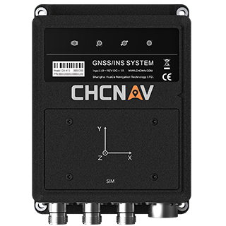
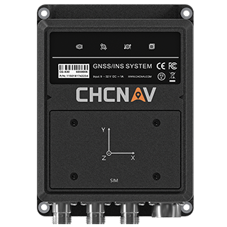
CHCNAV’s CGI-610 and CGI-830 receivers support two main PPP correction services: PPP-B2b and E6-HAS.
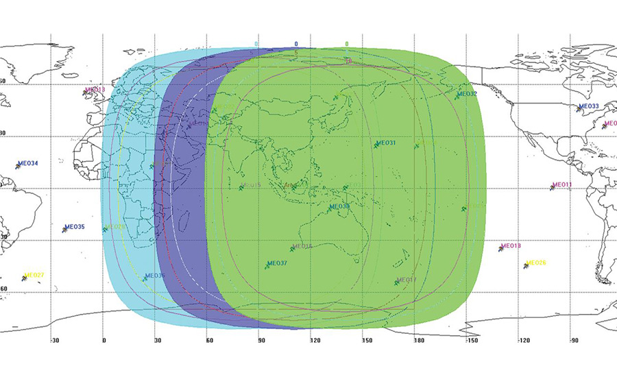
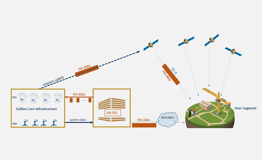
PPP-B2b : Broadcast via the BeiDou B2b signal from three GEO satellites, this service provides orbit and clock corrections for GPS and BDS constellations. Coverage extends across China and surrounding regions.
E6-HAS : Transmitted via the Galileo E6-B signal, this global service provides corrections for both GPS and Galileo. It enables users to achieve decimeter-level accuracy without internet connectivity.
PPP Positioning Mode on CHCNAV CGI GNSS+INS Receivers
Activating PPP positioning modes on the CGI-610 and CGI-830 receivers is straightforward. Users can connect via Wi-Fi, enter the configuration interface, and select PPP-B2b, E6-HAS, or the PPP/RTK adaptive mode depending on their region and operational requirements.
When using PPP-B2b or E6-HAS, it is recommended to stay stationary or operate in open environments for 10–20 minutes to allow PPP convergence. Once convergence is reached, the receiver’s PPP positioning status window will display a stable solution.
The PPP/RTK adaptive positioning mode is particularly valuable in environments with unstable differential signals, such as open-pit mines. The mode works by:
Defaulting to RTK positioning when network corrections are available, achieving centimeter-level accuracy within seconds.
Initializing PPP positioning convergence in the background at the same time.
Comparing PPP and RTK outputs to ensure consistency before handing over.
Automatically switching to PPP positioning when differential signals are lost to maintain uninterrupted accuracy.
The Future of PPP Positioning and Network RTK Integration
The next generation of GNSS positioning systems will further refine the fusion of PPP and RTK technologies through optimized algorithms and more sophisticated onboard intelligence in receivers.The CGI-610 and CGI-830 receivers already support adaptive PPP/RTK modes, providing continuous centimeter-level positioning based on the availability of real-time correction data.
In the future, space-ground fusion technologies such as CHCNAV's PointX correction services will further improve positioning accuracy. Dynamic selection of the most accurate correction source (NRTK or PPP) will enable smarter and more robust positioning solutions for industries such as transportation, surveying, mining, and agriculture.
For more information on PPP capabilities, evaluation opportunities, or tailored solutions, please visit the CHCNAV Inquiry page.
____
About CHC Navigation
CHC Navigation (CHCNAV) develops advanced mapping, navigation and positioning solutions designed to increase productivity and efficiency. Serving industries such as geospatial, agriculture, construction and autonomy, CHCNAV delivers innovative technologies that empower professionals and drive industry advancement. With a global presence spanning over 140 countries and a team of more than 2,000 professionals, CHC Navigation is recognized as a leader in the geospatial industry and beyond. For more information about CHC Navigation [Huace:300627.SZ], please visit: www.chcnav.com

.png)
.png)